Skip to content
Top-rated outdoor gear, ranked

Best Of 2026

Best Adventure GPS Devices of 2026

Our top 11 picks, independently ranked. Budget to premium.

For hikers, backpackers, and adventure travelers, a dedicated GPS device is the one piece of kit that keeps working when your phone dies, loses signal, or gets soaked. Unlike a smartphone, a purpose-built handheld runs for days on a set of AA batteries or a single charge, shrugs off rain and drops, reads clearly in direct sun, and, on the satellite-equipped models, can summon help from places with no cellular coverage at all. In 2026 the handheld market is overwhelmingly a Garmin story: the company that absorbed most of the old competition (Magellan, DeLorme) now sets the entire category, so this guide reflects that reality honestly rather than padding the list with discontinued or rebadged units.

The meaningful decision isn't really brand, it's what job you want the device to do. At the low end you get rugged, no-frills trackpoint navigation that pairs with your phone for maps. In the middle you add multi-band reception, color topo maps, and barometric altimeters. At the top you fold in two-way satellite messaging and SOS, turning a navigator into a genuine lifeline for solo and remote travel. Battery format matters too: swappable AAs (eTrex, GPSMAP 65) let you resupply power on a thru-hike, while rechargeable lithium units (GPSMAP 67, Montana) deliver longer single-charge runtimes but need a power bank.

We've spread the picks deliberately across the price spectrum so you can see exactly what an extra hundred or three hundred dollars actually buys, the kind of side-by-side context a retail listing never gives you. Spend up only for the capability you'll use; a weekend day-hiker and a remote-Alaska backpacker have very different right answers.

At a glance

#ProductPrice
1$550–$600
2
GPSMAP 67

Garmin

$450–$500
3
eTrex SE

Garmin

$120–$150
4$400–$450
5
eTrex 32x

Garmin

$200–$260
6$350–$400
7$450–$500
8$280–$300
9
eTrex 22x

Garmin

$150–$180
10
GPSMAP 65

Garmin

$300–$350
11$700–$750
GPSMAP 67i
Best OverallPremium

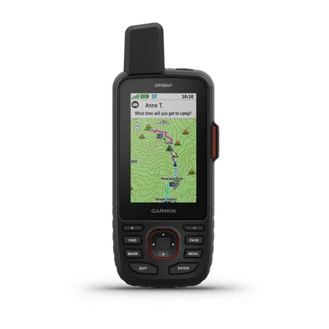
1. GPSMAP 67i

Garmin

$550–$600

The do-it-all handheld: full onboard topo maps and downloadable satellite imagery combined with inReach two-way messaging and SOS, plus a class-leading battery. For a serious hiker who wants one device to navigate and call for help, this is the one.

Best for: Backpackers and remote/solo travelers who want navigation and rescue in one rugged unit

Onboard topo + downloadable satellite imagery with full standalone navigation · Integrated inReach satellite messaging and SOS from anywhere · Multi-band GNSS for accuracy in canyons and tree cover · Up to ~165 hours of battery life on a charge

Expensive, and inReach features need a paid subscription · Button-operated 3-inch screen, not a touchscreen · Rechargeable battery means carrying a power bank on long trips

GPSMAP 67
Editor's PickPremium

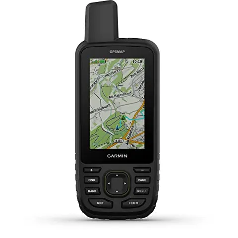
2. GPSMAP 67

Garmin

$450–$500

Everything that makes the 67i a great navigator (multi-band GNSS, onboard topo, satellite imagery, huge battery), minus the inReach radio and subscription. If you already carry a phone for emergencies, this is the smartest full-power buy.

Best for: Map-focused hikers who want maximum navigation without monthly fees

Full standalone topo navigation with downloadable satellite imagery · Excellent multi-band accuracy and ~180-hour battery life · No mandatory subscription, pay once for the hardware

No satellite messaging or SOS · Still a premium price for a non-communicator · Buttons-only interface feels dated next to touchscreen Montanas

eTrex SE
Best BudgetBudget

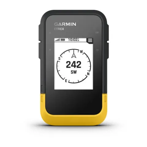
3. eTrex SE

Garmin

$120–$150

Garmin's modern entry point: a crisp monochrome screen, multi-band reception, and absurd battery life for the money. It has no preloaded maps, but paired with the Garmin Explore app it covers route planning and tracking for most hikers.

Best for: Day hikers and beginners who want a reliable, affordable trackpoint navigator

Inexpensive with modern multi-band GNSS · Up to ~168 hours on 2 AA batteries (far more in expedition mode) · Lightweight, rugged, and dead-simple to use

No onboard color maps, leans on the paired phone app · Monochrome display only · No barometric altimeter or compass

inReach Mini 3
Best ValueMid-range

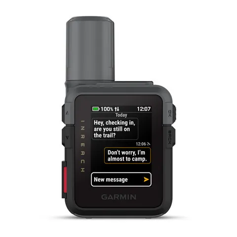
4. inReach Mini 3

Garmin

$400–$450

The featherweight safety net. On-device navigation is limited, but as a pocketable two-way satellite messenger with SOS it's the single best insurance policy a backpacker can clip to a pack strap, especially paired with the Explore app.

Best for: Hikers who navigate with their phone but want satellite SOS insurance

Tiny and light enough to bring on every trip · Two-way satellite messaging and SOS anywhere on Earth · Strong battery life and improved interface over the Mini 2

Very limited standalone navigation, best paired with a phone · Requires an inReach subscription · Small screen makes typing messages slow

eTrex 32x
Budget

5. eTrex 32x

Garmin

$200–$260

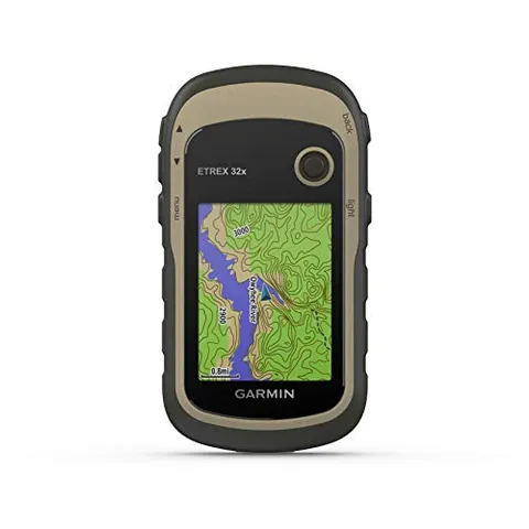
The sweet spot of the budget eTrex line: a sunlight-readable color screen, preloaded TopoActive maps, plus a 3-axis compass and barometric altimeter, real onboard navigation without breaking $300.

Best for: Hikers who want standalone color topo maps and sensors on a budget

Color display with preloaded topo maps onboard · 3-axis compass and barometric altimeter included · Runs on 2 AA batteries for ~25 hours

Older single-band receiver, less accurate than GPSMAP/eTrex SE · Small 2.2-inch screen · Fiddly button-and-joystick interface

GPSMAP 65s
Mid-range

6. GPSMAP 65s

Garmin

$350–$400

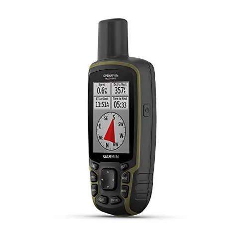
A button-operated workhorse with expanded multi-band satellite support, a 2.6-inch color screen, and, in the 's' version, an altimeter and compass. AA batteries make it a thru-hiker's friend, with no subscription strings attached.

Best for: Accuracy-focused hikers who want AA power and onboard sensors

Multi-band GNSS for strong accuracy under cover · Barometric altimeter and 3-axis compass (s model) · AA-battery powered, swap cells on the trail, no subscription

Dated button interface and modest screen size · No satellite messaging or SOS · Heavier than the eTrex line

Montana 700
Premium

7. Montana 700

Garmin

$450–$500

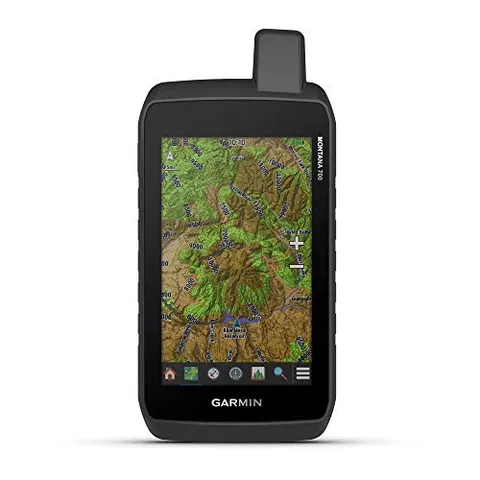
The big-screen option: a glove-friendly 5-inch color touchscreen with routable mapping for roads and trails. It's the most phone-like handheld to navigate, ideal for those who hate fiddly buttons or also use it on an ATV or boat.

Best for: Hikers who want a large touchscreen and multi-sport routable maps

Large 5-inch glove-friendly touchscreen, easy to read and pan · Routable on-road and trail mapping · Rugged and versatile across hiking and powersports

Large and heavy for ultralight backpacking · No inReach (step up to the 700i/750i for SOS) · Touchscreen drains battery faster than button units

inReach Messenger
Mid-range

8. inReach Messenger

Garmin

$280–$300

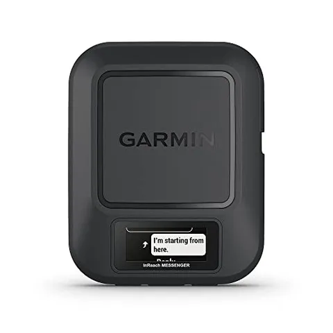
A purpose-built two-way satellite messenger with excellent battery life and a simpler, cheaper take than the Mini 3. It's about communication and SOS rather than maps, a budget-minded way to add a satellite lifeline to your phone-based navigation.

Best for: Phone navigators who want affordable satellite SOS and texting

Affordable entry into satellite messaging and SOS · Very long battery life for extended trips · Can relay messages and recharge a phone in a pinch

No onboard maps or real navigation display · Requires an inReach subscription · No barometric or topo features

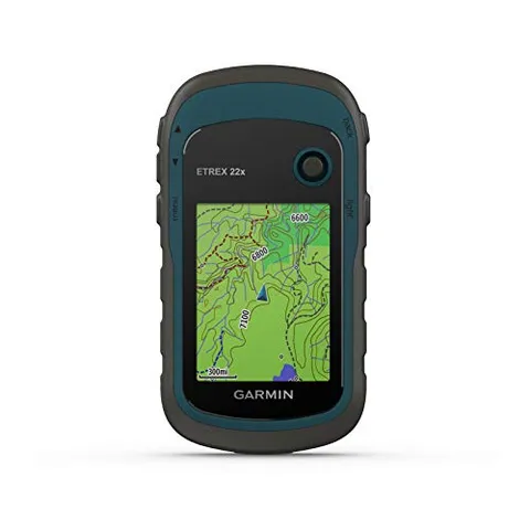
eTrex 22x
Budget

9. eTrex 22x

Garmin

$150–$180

The classic cheap-and-cheerful color handheld: preloaded base maps, a bright 2.2-inch display, and 25 hours on AAs. It skips the altimeter and compass of the 32x, but for straightforward trail tracking it's hard to beat the price.

Best for: Budget hikers and geocachers who want simple color trail navigation

Affordable color screen with preloaded base maps · Up to 25 hours on 2 AA batteries · Compact, rugged, and beginner-friendly

No barometric altimeter or 3-axis compass · Older single-band receiver · Small low-resolution display

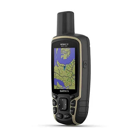
GPSMAP 65
Mid-range

10. GPSMAP 65

Garmin

$300–$350

The non-sensor sibling of the 65s: multi-band accuracy and a 2.6-inch color display on AA power, minus the altimeter and compass. A good middle pick when you want better-than-eTrex reception without paying for inReach.

Best for: Hikers wanting multi-band accuracy and AA power at a mid price

Multi-band GNSS for solid accuracy under cover · AA-battery power with no subscription · Larger, clearer color screen than the eTrex line

No barometric altimeter or compass (step up to the 65s) · Button-only interface · No satellite messaging

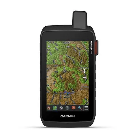
Montana 750i
Best PremiumPremium

11. Montana 750i

Garmin

$700–$750

The top of the line: the Montana's huge 5-inch touchscreen and routable maps plus integrated inReach SOS and an 8-megapixel geotagging camera. It's heavy and pricey, but no other handheld combines this screen, navigation, and satellite safety.

Best for: Adventure travelers who want a big-screen all-in-one with satellite SOS

Large 5-inch touchscreen with routable trail and road maps · Built-in inReach satellite messaging and SOS · 8-megapixel camera geotags photos to your track

Heaviest and most expensive pick here · Touchscreen and big display shorten battery life · inReach features require a subscription

How we choose

We selected and ranked these units by overall usefulness to people who hike, backpack, and travel into the backcountry (weighing navigation capability, battery life and power format, screen sunlight-readability, durability/water resistance, weight, and (where applicable) satellite SOS and messaging), then sanity-checked each against current 2026 street prices and published reviews from GearJunkie, Switchback Travel, OutdoorGearLab and Garmin's own spec sheets. The three tiers are price-and-capability bands: budget (~$120–$260) covers rugged trackpoint navigators that lean on a paired phone for maps; mid (~$280–$450) adds multi-band GNSS, color topo mapping, sensors, or standalone satellite messaging; premium (~$450–$750) is the do-it-all gear with onboard topo plus satellite imagery, large touchscreens, and integrated inReach SOS. Rankings reflect overall recommendation for a typical hiker, not price, a cheaper unit can outrank a pricier one if it's the smarter buy for most people. This guide is editorially independent: no manufacturer paid for placement or review, picks are based on published specs and third-party testing, and the retailer links may earn a commission at no cost to you, which never affects rank or inclusion.

Common questions

For casual day hikes on well-marked trails, a phone with a downloaded offline map (e.g. Gaia GPS or onX Backcountry) is often enough. A dedicated handheld earns its place on longer, remote, or solo trips: it gets far better battery life, takes swappable batteries on some models, survives water and drops, reads better in glare, and, critically, the satellite-messaging units can call for rescue where there's zero cell coverage. Think of it as redundancy and a safety device, not just a map.

A traditional GPS (eTrex, GPSMAP 65) shows your position on a map and records tracks, but can't send a message anywhere without cell service. A satellite communicator (inReach Mini 3, inReach Messenger) uses the Iridium network for two-way texting and SOS from anywhere on Earth. The top units (GPSMAP 67i, Montana 700i/750i), combine both: full onboard navigation plus inReach. Satellite features require a paid subscription on top of the hardware.

Yes. Any inReach-enabled device (Mini 3, Messenger, GPSMAP 67i, Montana 700i/750i) needs an active Garmin satellite plan to send messages or trigger SOS. Garmin offers flexible monthly plans you can suspend in the off-season and cheaper annual plans for frequent users. Plain GPS units like the eTrex and GPSMAP 65 have no subscription at all, you pay once for the hardware.

It depends on trip length and resupply. AA-powered units (eTrex SE, eTrex 22x/32x, GPSMAP 65) let you carry spare cells and swap them mid-trip, ideal for multi-day or off-grid travel where you can't recharge. Rechargeable lithium units (GPSMAP 67/67i, Montana) offer longer single-charge runtimes (100+ hours) and recharge from a power bank, which suits trips where you carry a battery pack anyway. There's no universally right answer, match it to how you'll resupply power.

Multi-band (multi-frequency) GNSS receivers, found in the GPSMAP 65/67 series and newer eTrex SE, track multiple satellite signal frequencies at once. In practice that means noticeably better accuracy in tough conditions (deep canyons, dense tree cover, near cliffs), where single-band units drift. If you mostly hike open terrain it's a nice-to-have; if you navigate slot canyons, old-growth forest, or technical terrain, it's worth paying up for.

Generally no. Magellan and DeLorme exited the consumer handheld space years ago, so most non-Garmin 'hiking GPS' units online are obscure unsupported imports with poor map data and no SOS. Garmin's own discontinued models (eTrex 10/20x/30x, GPSMAP 64) still work but lack multi-band accuracy and updated software. The current eTrex SE and eTrex 22x deliver modern performance at entry-level prices, so there's little reason to gamble on something older or off-brand.

Some links are affiliate links, and we may earn a commission at no extra cost to you. It never affects our rankings.

In your pocket

Take the whole adventure with you.

Free, no account needed. GPS tracking, trail maps, and multi-stop route planning in your pocket.

  • Every tour and outfitter in your pocket

  • GPS-track the whole day, hands-free

  • Plan and save multi-stop routes before you go

  • GPS tracking that keeps recording past the trailhead

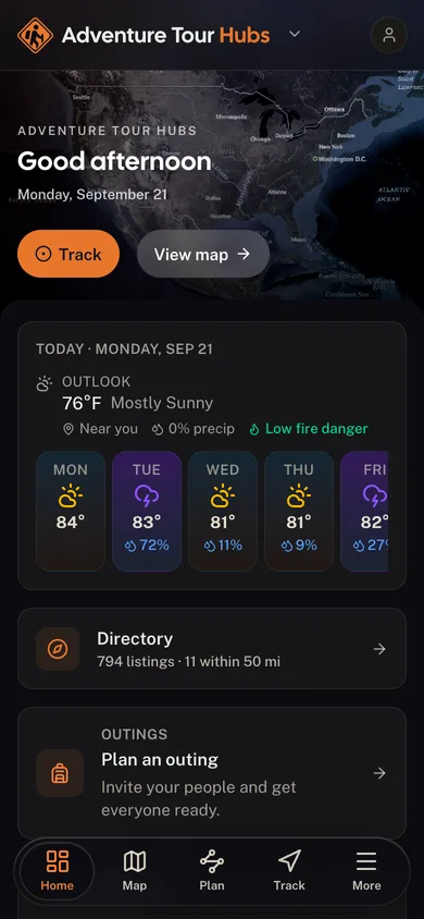
The Adventure Tour Hubs app dashboard

For operators

Run your adventure business?
Launch your branded surface.

Get your own branded surface in the Adventure Tour Hubs app and a directory listing in minutes. Bookings, digital waivers, and your whole operation live in one cockpit.